

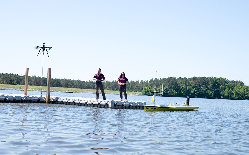
GRI continues coastal impact
In 2004, a group of Mississippi State researchers began digitizing land and water records for communities along the Mississippi Coast—documenting water movement, watersheds, topography and topology.
A year later, those digital files proved invaluable when Hurricane Katrina decimated the state’s Gulf Coast. Since then, that research, spearheaded by MSU’s Geosystems Research Institute, has evolved into a vital ecological and economic lifeline for the state.
GRI Director Robert Moorhead, who also serves as director of the Northern Gulf Institute, said the value in this research carries weight for those who live on the Coast and rely on it economically.
“Hurricane Katrina destroyed a lot of those paper records,” Moorhead said. “The Coast needed a lot of help, so we started teaching a lot of classes at Stennis Space Center on how to process raw data and research, then turn it into maps. This information, these records, are vital and we’ve actively worked to get those records in the public’s hands.”
These records do more than fill archives. By creating an understanding of the historical movement of water, GRI provides the data necessary to bolster both the environment and the local economy, providing an understanding of the “what” and “why” of the Mississippi coastline and bridging the gap between raw data and real-world recovery.
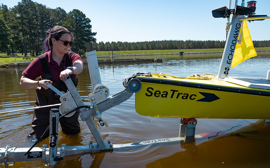
Mississippi State Geosystems Research Institute engineer Paige McCraine launches a SeaTrac autonomous surface vessel used for continuous data collection from the water.
Eyes in the sky and water
Established in 2000, the mission of GRI remains the same. However, the methods it employs continually evolve, leveraging new technologies to increase research effectiveness and impact. For instance, the institute has swapped invasive, traditional methods of measurement for a high-tech fleet of uncrewed vehicles, or drones, that monitor the environment from both the air and the sea.
Daniel McCraine, a GRI research engineer and MSU alumnus, uses Uncrewed Aerial Systems to monitor the seafloor. Using single beam dual frequency downward looking sonar, Daniel’s drones measure bathymetry, or the distance from the water’s surface to the seafloor.
“What we’re doing is comparable to a sea vessel getting information on depth and seafloor composition,” explained the 2018 and 2020 engineering graduate. “The difference is, we can use UAS in hard-to-reach areas that traditional vessels, even uncrewed ones, can’t explore.”
Even in areas that can be explored more traditionally, Moorhead said the benefits of using these advanced UAS can give coastal researchers a much more detailed ecological look.
“We are able to fly over and measure the rise and fall of the water without harming the environment,” he explained. “We are giving researchers sub-inch resolution in 20 minutes compared to sub-meter resolution over the span of hours.”
The institute continues to explore data-collection methods from all angles. Paige McCraine, also a GRI research engineer and MSU graduate, conducts her coastal research from the water via the SeaTrac, a fully automated, remote-controlled surface vessel.
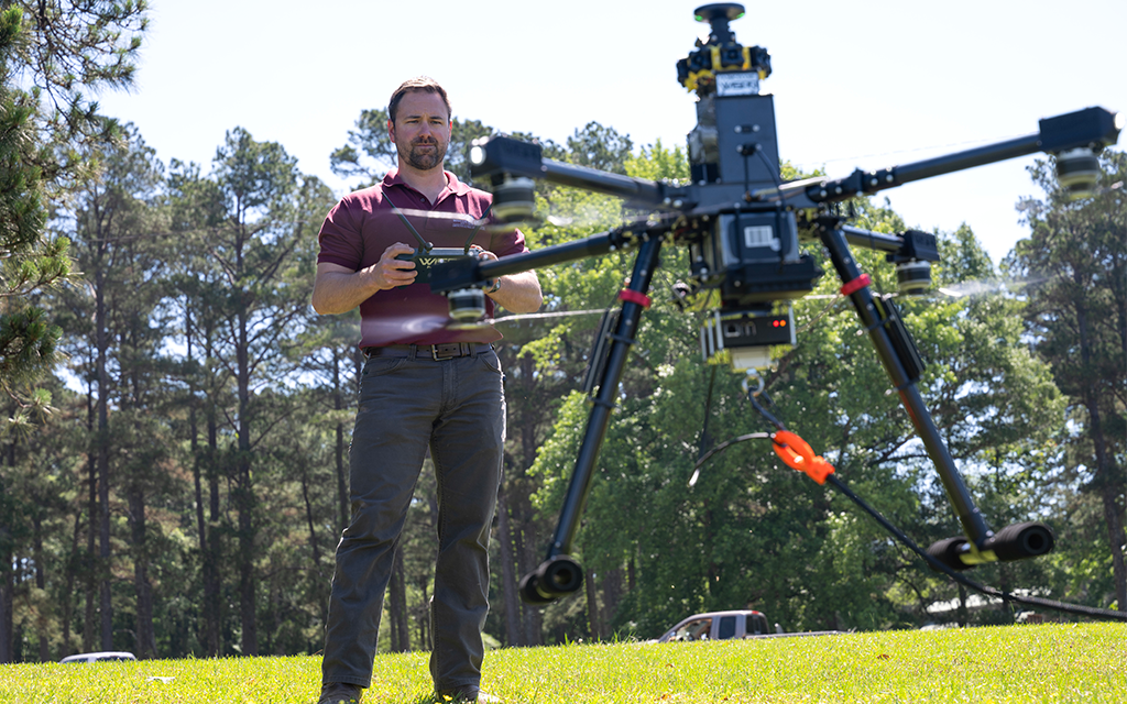
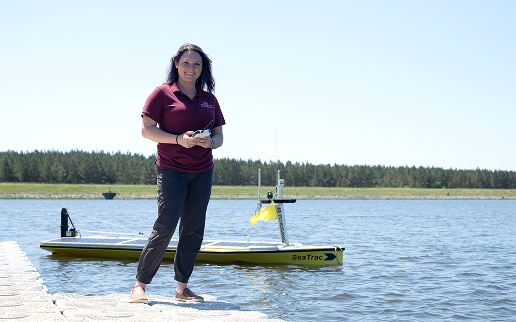
Fellow GRI engineer Daniel McCraine, center, surveys environments from airborne drones. Together, the married duo collects environmental data on the Coast from above and below.
“From the time we launch it into the water until the time we take it out, it’s collecting data,” the 2016 engineering graduate said. “We use a real-time dashboard that shows the variation in different metrics during each mission. So, we’re not only getting spatially dispersed targets across the coast, we’re getting miles of continuous data.”
The McCraines represent the multidisciplinary spirit of the GRI. By pairing aerial drones with aquatic uncrewed vessels, they can pinpoint environmental concerns to very specific areas. The husband and wife duo plan to partner for future projects as well, relying on each other’s expertise.
“We have the potential to use UAV to identify an area of interest and then put the SeaTrac in the water to gather verifiable data,” Daniel said. “So we can canvass a large area and find specific areas to use the SeaTrac to get high-resolution data in those localized areas.”
All hands on deck
Moorhead said GRI’s strength lies in its “all-hands” approach. With a staff of roughly 20 experts ranging from plant pathologists to electrical engineers, the institute ensures that no problem is viewed through a single lens.
“We don’t have engineers trying to solve a science problem alone,” Moorhead explained. “We all work together to get a full scope of the answer.”
This collaboration was put to the test in 2019, when a massive influx of freshwater was diverted into the Mississippi Sound via the Bonnet Carré Spillway. While the levee system succeeded in its primary goal of flood control, it resulted in an ecological disaster that saw the water’s salinity drop to nearly zero, leading to hundreds of sea turtles and dolphins washing ashore.
By deploying the SeaTrac and UAS technology, researchers like the McCraines, plant pathologist Gray Turnage and mapping expert John Cartwright were able to track salinity plumes and water movement in real time. Working with the Mississippi Department of Marine Resources and other key partners, MSU provided critical data and expertise needed to analyze the devastating impacts of the Bonnet Carré Spillway opening.
This type of data serves as the primary defense for the Sound’s health, protecting the fishing and tourism industries that the region depends on.
“We need to understand the environment in which we live to make the best use of what it provides and to maintain it for future generations,” Moorhead said. “The research that MSU does on the Coast, the most dynamic environment in the state, specifically helps us piece everything together. Each finding helps refine our understanding of how the soil, water, plants and air interact within the environment.”
By Mary Pollitz, Photos by Beth Wynn