

MSU-led GIS trainings help tribal populations better manage homelands
The natural world of sub-Arctic Alaska defines the life and identity of Leilani Luhrs.
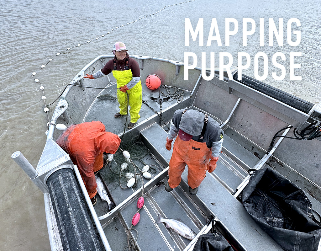
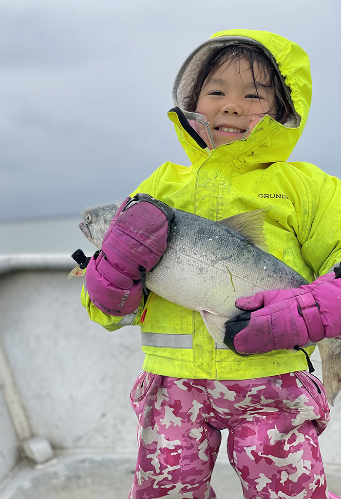
A member of the Traditional Council of Togiak, one of 27 Native American villages in Alaska’s Bristol Bay region, her roots run through the land and sea of her home, where she first fished commercially at age 11. As an adult, she has worked to monitor the area’s natural resources in many ways, including mapping migration patterns of salmon and tracking invasive fish species, for tribal, state and federal entities.
Luhrs’ understanding of her home, she said, is built on knowledge passed down by her ancestors and a modern-day, supplemental tool: geographic information systems, or GIS, that merge data and mapping, thereby allowing people to make better land-use decisions based off a more comprehensive understanding of the world around them.
With help from Mississippi State University experts, Luhrs is sharing her GIS knowledge with area high schoolers to help a new generation better connect with, understand and manage their environment.
“GIS—the understanding of your world through maps and data—can be anything. It’s almost limitless. All throughout my adult life, I’ve used GIS without knowing it,” she explained. “Tools like GIS are important for young students because they help grow relationships between them, the land, our communities and our culture.
“It’s a vital bridge between our traditional way of life and the scientific world,” she continued. “This pathway opens the door for our community—the indigenous people of Alaska—to be better advocates for ourselves and our region.”
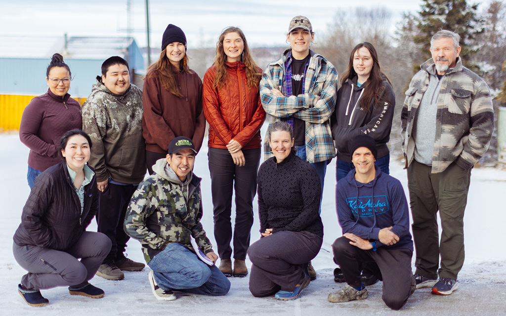
Luhrs is one of almost 1,000 people across more than 30 states who have received training through the Geographic Information Systems Training for Tribal Populations Project, a partnership between MSU’s Geosystems Research Institute and the U.S. Department of Interior’s Bureau of Indian Affairs empowering native communities with skills to enhance resource management and cultural preservation for the further development of tribal lands.
Launched in 2024 and supported by a NOAA Regional Geospatial Modeling Grant, the program focuses on introductory and intermediate training for ArcGIS, a family of geospatial mapping software developed by the Environmental Systems Research Institute, or Esri. Free and made available online four times last year, the training was open to all federally recognized tribal and BIA employees, including contracted tribal workers. With a growing demand, organizers also hosted an in-person session last year in Alaska and plan to provide additional offerings in the future across the U.S.
“We want to help teach people how to better manage their land—teach them how to map boundaries and assess issues like sea-level rise, for example—so they can share this information with others and take action to help mitigate or take advantage of some of the things that are happening,” said Dixie Cartwright, a training facilitator with MSU’s GRI. “If you look at some of the tribal areas in Alaska and Louisiana, for example, they’re losing a lot of their land due to both natural and anthropogenic activities. GIS can help identify their most vulnerable areas so they can take action and ensure they will still have their land 15 to 50 years from now.
“But it’s not just data. A lot of knowledge from these different tribes is being lost from their elders—it’s not getting passed down to the younger generations within these groups,” she continued. “Being able to teach GIS skills and show how their land has changed over the years is opening the doors for conversations between the generations to help them learn more about their homes and what they can do to protect them.”
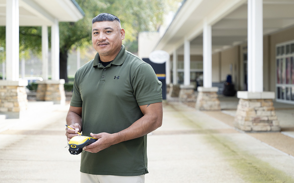
Roddy Nickey, below, and Leilani Luhrs, center left, are among the almost 1,000 people across more than 30 states who have received training in geographic information systems, thanks in part to Mississippi State. Luhrs says the technology is “a vital bridge between our traditional way of life and the scientific world.”
Protecting and preserving
For Roddy Nickey, data is history.
As the director of land management for the Mississippi Band of Choctaw Indians, Nickey uses GIS to oversee the tribe’s approximately 35,000 acres. Data the two-time MSU graduate collects and the maps he creates are used in a wide variety of decisions, from better managing city growth through conscious zoning designations and integrating newly acquired land into the nation, to understanding land involved in major infrastructure projects and monitoring the environmental health of timber-producing areas over decades.
“To me, data and information are two different things. What you take in is the raw data, and what you send out to people is information. Good information requires good data,” said Nickey, who has completed GRI training sessions. “Using GIS helps us protect and preserve our data, and plan accordingly for the future. We have to protect our data, because that’s our history.”
Luhrs has found that using map-centric video games like Fortnite and Call of Duty as a gateway to GIS helps contextualize the topic for high schoolers. Building their interest at a young age helps ensure valuable tribal-land data makes it to the next generation.
“They’re playing these types of games with their friends, and they’re building maps to go along with them. I tell them, ‘You guys are literally playing ArcGIS,” she said. “Once they see the similarities, we start adding on data and components, tying everything together to what’s possible locally.
“We’re trying to show them how important environmental monitoring is—to build the relationship between the land and environment to their community and culture,” Luhrs continued. “It’s important to build up this capacity for our communities, because we don’t have many people who can bridge the gap between our traditions and the West. These students can use GIS for their subsistence and cultural interests as they get older, giving them the ability to be the future stewards we need and allowing them to preserve our ways of life.”
Both Luhrs and Nickey credit the GRI’s tribal training program and the expert knowledge guiding them as significant boons to the professional careers. Luhrs said instructors including GIS Coordinator Claire Babineaux broke down complex ideas into layman’s terms, making topics easily understandable for her entire class.
“Since then, I feel like the number of opportunities to use and share this knowledge with others here has exploded,” Luhrs said. “It opened a door to a vast number of things, because many places here in Alaska have not been mapped to this level of detail.”
“Because of MSU, I was able to learn about the latest software tools and how to use them—becoming more effective at my job—at my own pace,” Nickey added. “Having these skills is important to me because of how many important parts of tribal life GIS work touches.”
Story by Carl Smith, Submitted photos